Carrying Capacity Must Be the Non-Negotiable Principle for Himalayan Development: Moving Beyond Dust-Gathering Reports to Hard Ground Action
Exactly three years ago, in August 2023, the Supreme Court of India stepped decisively into an unraveling ecological disaster. Responding to a public interest petition, the bench demanded an uncompromising, scientific audit of carrying capacity across the 13 states and union territories that make up the Indian Himalayan Region (IHR). That judicial hammer fell for good reason. It drew directly from the National Green Tribunal’s (NGT) benchmark February 2023 order on Mussoorie—a direct outcome of the alarming land subsidence that tore open the town of Joshimath. The court’s order was straightforward: establish the hill station’s physical limits and enforce them without exception.
Here we are in August 2026. Four months back, in April 2026, the NGT received a consolidated compliance filing mapping tourist footprints across the region. Just days ago, on August 6, 2026, Union ministers formally laid those exact findings on the floor of Parliament. Yet, across the mountain arc, the gulf between official paper and mountain ground remains dangerously wide. Union Budget 2026 has funneled fresh capital into high-altitude trekking corridors and eco-tourism projects. Meanwhile, fragile mountain hubs remain trapped in a spiral of institutional drift, heavy reports, and broken entry tracking.
The Indian Himalayan Region stretches over 2,500 kilometres and supports nearly 50 million residents. If this fragile ecosystem is to survive the combined force of erratic climate shocks and aggressive urban sprawl, ecological carrying capacity cannot remain a comfortable legal abstraction. It must become the unyielding baseline for every government budget, every mountain highway blueprint, and every construction permit issued in the hills.
1. The Anatomy of Ecological Carrying Capacity—and Its Climate-Driven Dynamics
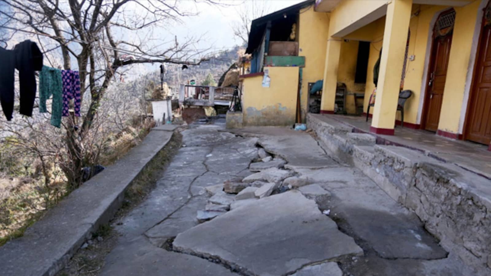
Carrying capacity is not an elastic policy compromise. It represents an absolute ecological ceiling: the maximum built infrastructure and human footprint a mountain ecosystem can endure before collapsing into structural failure. In high-altitude zones, this threshold relies on four connected pillars:
- Physical & Geological Carrying Capacity: The hard limit of slope stability, soil shear strength, and structural load tolerance before physical stress triggers destructive landslides or deep land subsidence.
- Hydrological Carrying Capacity: The ultimate extraction limit beyond which natural mountain springs (dhara) dry up and break subsurface water channels—the concealed aquifers and secret streams feeding high-altitude environments.
- Ecological Carrying Capacity: The breaking point where tree clearing, habitat splintering, and unmanaged waste overwhelm the natural bioremediation capabilities—the intrinsic power of soil microbes, wetlands, and mountain soils to process organic and chemical runoff.
- Infrastructural & Social Carrying Capacity: The absolute cap on human presence (combining local residents and seasonal surges) that municipal waste facilities, sewer grids, roads, and emergency services can manage safely.
The Shift from Static Thresholds to Dynamic Realities
For generations, urban planners viewed carrying capacity as a fixed calculation—a single static number locked into a master plan. The environmental events of 2026 have shattered that logic. Climate disruption has transformed carrying capacity into a highly dynamic, shifting variable.
Downpours hit with fierce intensity today. Glaciers are receding at alarming rates. Monsoon paths have drifted off their historical tracks. As a result, mountain slopes and drainage catchments carry far higher structural risks than they did a decade ago. A hillside or local water table that handled a given urban load in 2016 operates at a far lower breaking point in 2026.
“Carrying capacity is not a static, negotiable policy guideline; it is a dynamic physical boundary dictated by real-time climate feedback, geology, hydrology, and atmospheric science. Treating 20th-century baseline figures as permanent operational thresholds is an invitation to ecological collapse.”
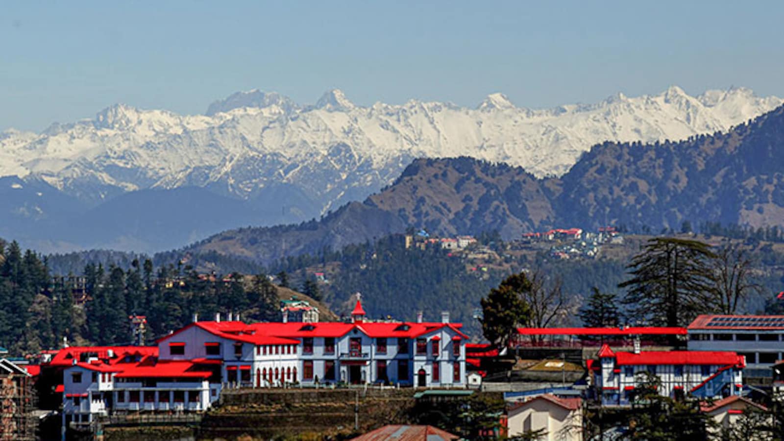
Take Shimla. British engineers originally designed its foundational services for a baseline population of 25,000 people. Today, the town’s permanent population stands at well over 800,000, ballooned further by constant waves of seasonal visitors. Combine this massive load with sudden, extreme rainfall, and the fallout is immediate: dry taps in midsummer, complete traffic gridlock, and lethal slope collapses along blasted highway corridors.
2. Policy Contradictions: Budget 2026 and the Eco-Tourism Dilemma
The gap between physical limits and official policy stands out starkly in national financial planning. Union Budget 2026 has placed heavy emphasis on high-altitude adventure travel, directing significant capital toward famous alpine trekking circuits, including:
- Himachal Pradesh: Hampta Pass and Beas Kund
- Uttarakhand: Valley of Flowers and Kedarkantha
- Jammu & Kashmir: Kashmir Great Lakes and Tarsar Marsar
Formalising trekking routes can improve safety, mark out trails, and generate local employment. However, alpine ecologists warn against rapid commercialisation. High-altitude meadows (bugyals) and glacial valleys exist on thin ecological margins. Pushing heavy foot traffic into these sensitive upper zones without strict daily quotas leads to quick soil compaction, trail erosion, unmanaged mountain waste, and wildlife distress.
Protecting high-altitude zones requires deliberate restraint. Mountain trail policy must be governed by real-time scientific data and strict daily visitor limits, not driven by top-down financial goals.
3. Mountain Destinations Under Pressure: A Comparative Overview
Across the Indian Himalayan Region, major towns and transit corridors demonstrate the direct physical price of exceeding ecological limits:
| Himalayan Destination / Zone | Historical / Baseline Limit | Present Day Demand & Operational Strain | Prevailing Bottleneck to Sustainable Development |
|---|---|---|---|
| Shimla (Himachal Pradesh) | Designed for 25,000 residents | Population exceeds 800,000 plus peak tourist surges | Draft Master Plans delayed or contested; chronic seasonal water shortages. |
| Mussoorie (Uttarakhand) | Ridge-constrained hill environment | Registrations peaked at 25,256 in May 2026 alone | Flawed digital entry mechanisms masking real footfall numbers. |
| Joshimath / Chamoli Belt | High-seismic, fragile slope zone | Major transit hub for pilgrimage and infrastructure projects | Unchecked structural expansion despite acute land subsidence in 2023. |
| Kasauli (Himachal Pradesh) | Restricted 2.5-storey height limit | Severe water stress, commercial land conversion | Unsanctioned construction extending beyond defined planning area limits. |
| Ladakh Trekking Routes | Arid, high-altitude ecosystem | High seasonal footfall along fragile valleys | Inadequate solid waste processing and remote camping management. |
4. From Paper to Action: A Blueprint for Ground-Level Accountability
To move past endless committees and position carrying capacity as the core of Himalayan governance, central ministries, state leaders, and local councils must execute five structural reforms:
I. Automated Real-Time Entry Infrastructure (With Built-In Privacy Frameworks)
Manual check-posts and self-reporting portals must be replaced with automated tracking networks. Installing automated number-plate recognition (ANPR) cameras, RFID entry gates, and real-time mobile tower density mapping will supply authorities with reliable, tamper-proof data on incoming vehicle flows and crowd volumes.
To protect personal privacy, these systems must run under strict data anonymisation protocols. Hardware should record aggregate traffic numbers and vehicle counts without capturing personally identifiable information (PII) or logging individual movements.
II. Navigating the Socio-Economic Dilemma: Decentralized Homestay Models
Local councils often hesitate to enforce visitor caps because local businesses—taxi operators, hoteliers, and shop owners—fear financial collapse. Top-down bans that ignore local survival invariably spark sharp resistance and widespread non-compliance.
The solution lies in restructuring how tourism operates. Shifting away from large, corporate-owned hotel blocks toward a decentralised community homestay network ensures financial returns remain directly within mountain communities.
Under standard resort models, roughly 70 per cent of tourist spending leaks out to external commercial entities, leaving local towns to manage the resulting pollution and gridlock. In contrast, dispersed homestays spread footfalls across peripheral villages, place revenue directly into local hands, preserve traditional timber-and-stone building methods, and prevent infrastructure overloads in dense town centres.
III. Inter-State Governance: The Trans-Boundary Himalayan Authority
Mountain ecosystems, river basins, and fault lines pay no attention to administrative boundaries. When one state diverts a river or permits rapid development, downstream mountain areas inherit the ecological impact.
The 13 states and union territories of the Indian Himalayan Region require a unified Trans-Boundary Himalayan Authority (TBHA). Equipped with statutory powers like international alpine commissions, this agency would set regional carrying-capacity caps, manage shared river basins, align cross-border transit routes, and stop individual states from shifting environmental damage onto their neighbours.
IV. Sustainable Financing: The “Himalayan Green Cess”
Setting up digital entry barriers, deploying ANPR networks, and running continuous ecological audits requires reliable funding—capital that financially stretched mountain municipalities lack.
To bridge this gap, state governments should introduce a dedicated “Himalayan Green Cess”—an environmental levy on non-resident private vehicles, commercial tourist buses, and luxury stays. Revenue would be legally ring-fenced into a dedicated state fund for local green infrastructure: constructing waste processing facilities, restoring dried mountain springs, operating real-time tracking systems, and supporting local homestay transitions.
V. Mandatory Dynamic Ecological Audits for Major Infrastructure
No highway expansion, hydroelectric tunnel, or commercial development should secure environmental clearance without an independent, peer-reviewed carrying capacity assessment. Hydroelectric drilling and road expansion must account for slope stability, soil shear limits, and subsurface water channels, calculating cumulative regional impact rather than relying on narrow, isolated project reports.
The Path Ahead
The geology of the Himalayas yields nothing to administrative delays or political compromises. Recent disasters—from the cracking streets of Joshimath to devastating floods along the Beas and Satluj basins—have repeatedly demonstrated the stark cost of ignoring physical limits.
The scientific frameworks exist. The legal directives are clear. The compliance reports sit ready on government desks. What remains is the political resolve to enforce firm limits. Respecting carrying capacity is not an attempt to freeze economic progress; it is the essential requirement for keeping the Himalayas safe, stable, and liveable for generations to come.
Summary
- Dynamic Ecological Imperative: Carrying capacity must act as a climate-sensitive, non-negotiable boundary, enforcing legal caps across all 13 Himalayan territories.
- Policy and Data Realities: Deep data flaws and uncounted tourist arrivals wreck municipal planning, clashing directly with national eco-tourism drives in Budget 2026.
- Structural Reform & Funding: Real enforcement requires automated tracking, trans-boundary governance, local homestays to protect livelihoods, and a Himalayan Green Cess for funding.
Never Miss an Update!
Subscribe to get personalized blog recommendations and instant notifications for new articles directly on your device.